|
| *****SWAAG_ID***** | 960 |
| Date Entered | 06/11/2016 |
| Updated on | 06/11/2016 |
| Recorded by | Tim Laurie |
| Category | Enclosure |
| Record Type | Archaeology |
| SWAAG Site | Reeth Low Moor |
| Site Access | Public Access Land |
| Record Date | 05/11/2016 |
| Location | Reeth Low Moor.This enclosure is Location R1 on Figure 6.14 in Laurie et al 2011. |
| Civil Parish | Reeth |
| Brit. National Grid | NZ 995 004 |
| Altitude | 395m |
| Geology | WND over Middle Limestone. Spring line. |
| Record Name | Reeth Low Moor. Cringley Bottom. Circular stone banked settlement enclosure with contained clearance mounds and two hut circles. |
| Record Description | See Location K1 0n the Location Map below, Reference: Laurie, White and Mahaffy 2011.'Co-axial field systems in Swaledale: a reassessment following recent fieldwork.'Figure 6.14.in; R.D.Martlew Ed.: 'Prehistory in the Yorkshire Dales'.PLACE/Yorkshire Dales Landscape Trust.
Circular stone banked enclosure some 70m diameter with contained clearance mounds and two hut circles on the NE perimeter. This enclosure has been slightly scooped into the hillside or local cultivation has formed an over steepened or lynchetted rear scarp. The two hut circles are usually masked by heather. A third hut circle is located approximately 100m to the east of the enclosure. Field banks abut and presumably incorporate the enclosure on both western and eastern perimeters, see Location Plan. The 19m diameter denuded cairn (RTH010) cairnfield (RTH011) and the coaxial field system (RTH012) all indicate lengthy prehistoric occupation with intensive cultivation or pastoral activity at Low Cringleywhich is a well watered, south facing elevated terrace.
This settlement complex may also have included the burnt mound (RTH006) which is located at a spring rise approximately 50m to the east of the enclosure.
There can be little doubt that this settlement enclosure is incorporated within a later, fully developed coaxial field system (RTH012) with fields running at right angles across the slope and may be also associated with the adjacent burnt mound.
A total of seven circular stone embanked enclosures have been located on Reeth Low Moor see Laurie et al 2011, Figure 6.12 and 6.14. Similar enclosures are present elsewhere in Swaledale where they are usually incorporated within coaxial field systems. For example on the west side of Grinton / Grove Beck Gill See Laurie et al 2011, Figure 6.9.
|
| Dimensions | Circular stone embanke enclosure 70m diameter approximately |
| Additional Notes | Note! The stone dump enclosure bank, round houses and cairn features of this feature are marked by and shrouded below deep heather, thus these features are all difficult to see on the photographs.
RTH005.05-11 Curvilinear stone embanked enclosure with two contained round houses and several large and irregular shaped clearance cairns. This enclosure is located and cut into the steep slope at the rear of the gently sloping wide terrace of Low Cringley. Substantial field banks abut this enclosure on both the western and eastern perimeter of the enclosure, see survey plan. These field banks form the upper limit, at around 400m of the coaxial field systems which extend across the whole length of Cringley Hill and Calver Hill. It can therefore be concluded that this enclosure predates field system, see also (RTH 012).
A total of seven similar circular embanked enclosures, some with visible contained round houses, have been recorded on Reeth Low Moor. One of these, the fine enclosure on Cringley Hill,has been recorded by the Ordnance Survey on the 1:25000 map and is site R4 on the attached survey
These circular embanked enclosures are as yet undated. They may be the local equivalent of the circular palisaded enclosures of the Cheviot Uplands which have been dated to the Late Bronze Age/Early Prehistoric Iron Age. in support of this suggestion, a similar stone banked enclosure further east on Riddings Rig has been visibly quarried out,is overlain by and clearly predates the later of the two coaxial field systems on Reeth Low Moor.
|
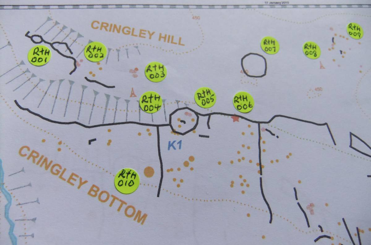
| Image 1 ID | 7025 Click image to enlarge |
| Image 1 Description | EDM Survey of Reeth low Moor, Western Section as Laurie et al 2011, Figure 6.14. This enclosure is Location K1 and RTH 005 on this plan |  |
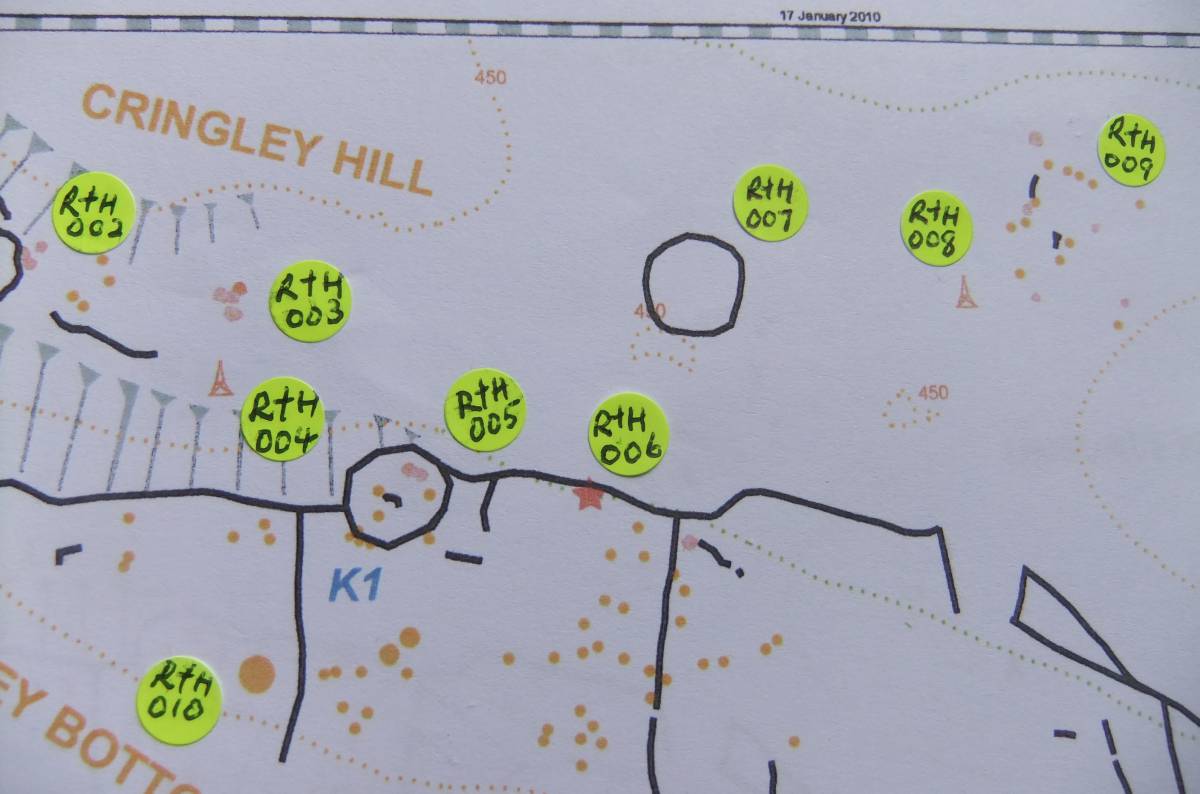
| Image 2 ID | 7026 Click image to enlarge |
| Image 2 Description | Detail of last | 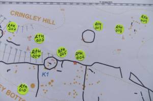 |
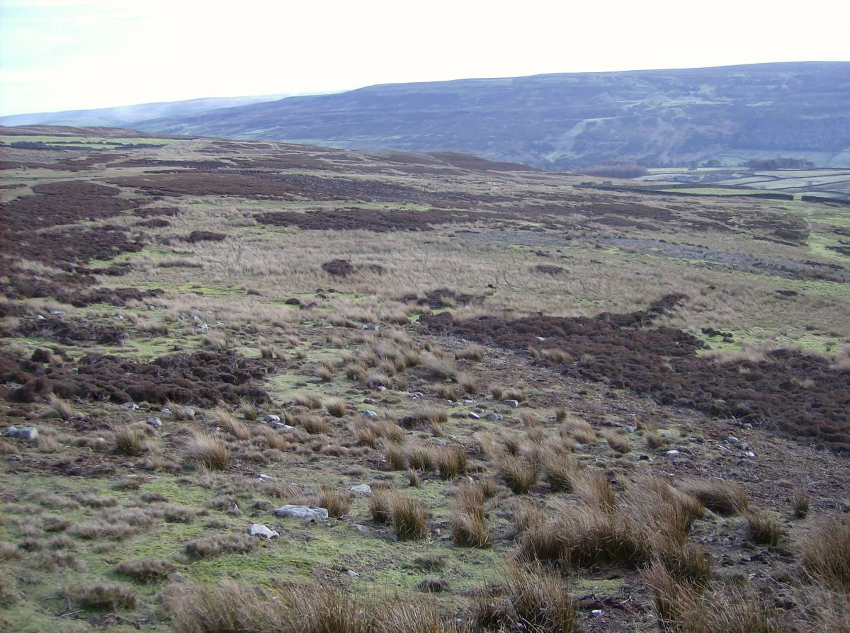
| Image 3 ID | 7027 Click image to enlarge |
| Image 3 Description | The enclosure bank viewed from the track down from Cringley Hill. Part of the curving heather covered bank is visible, the remainder is masked by vegetation. |  |
| Image 4 ID | 7029 Click image to enlarge |
| Image 4 Description | The enclosure bank shrouded in heather. | 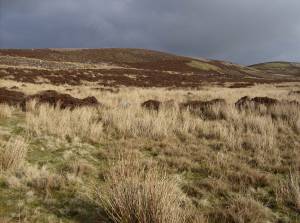 |
| Image 5 ID | 7030 Click image to enlarge |
| Image 5 Description | The enclosure bank shrouded in heather. | 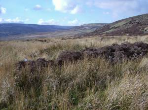 |